


Le Mont Caume-17-03-21

Christiancordin
User
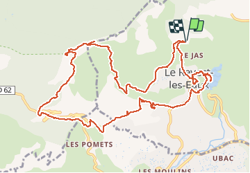

Length
15.2 km

Max alt
727 m

Uphill gradient
774 m
Km-Effort
25 km

Min alt
113 m

Downhill gradient
777 m
Boucle
Yes
Creation date :
2021-03-17 07:27:21.072
Updated on :
2021-03-17 17:42:52.694
5h30
Difficulty : Difficult

FREE GPS app for hiking
 SityTrail
IGN / Geographical institutes
SityTrail Plus
The world is yours!
About
Trail Walking of 15.2 km to be discovered at Provence-Alpes-Côte d'Azur, Var, Le Revest-les-Eaux. This trail is proposed by Christiancordin.
Description
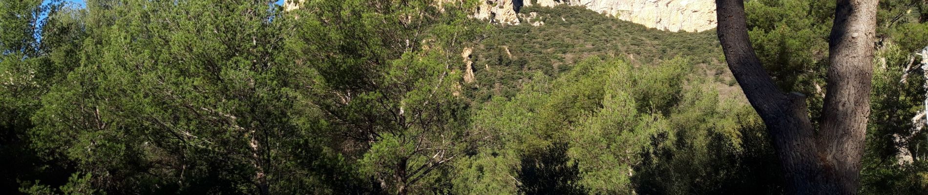
Pk du stade du Revest-le Haut Rey-ravin de Mal Vallon-mont Caume-col du Corps de Garde-pont des Marlets-GR 51-chemin Notre Dame-le barrage-le Revest les eaux-tour-GR 99.
Photos


Positioning
Country:
France
Region :
Provence-Alpes-Côte d'Azur
Department/Province :
Var
Municipality :
Le Revest-les-Eaux
Location:
Unknown
Start:(Dec)
Start:(UTM)
737690 ; 4785369 (31T) N.
Comments